树木森林勾画出的美国地图 [美国媒体]
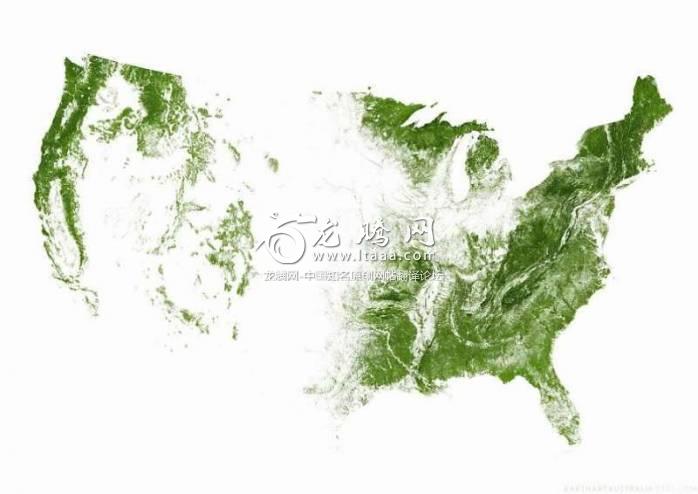
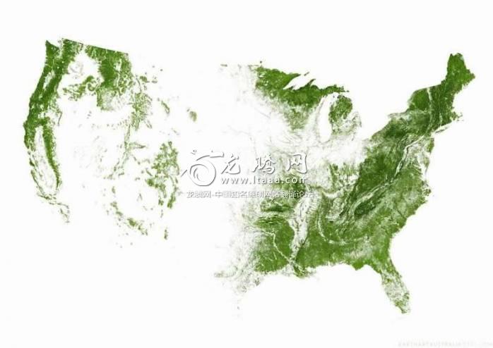
由超过10亿英亩的树木与森林的美丽自然模式勾画出的美国。这幅地图使用开源地图软件QGIS绘制,利用了汉森等人2013年的数据和来自CGIAR-CSI SRTM90米数据库的90米数字化高程数据。
The United States mapped by the beautiful natural patterns of over 1000 million acres of trees & forests! Map created with open-source QGIS (http://www.qgis.org/en/site/), using data from Hansen et al. 2013 (http://earthenginepartners.appspot.com/science-2013-global-forest) and 90m digital elevation data from the CGIAR-CSI SRTM 90m Database (http://srtm.csi.cgiar.org)
由超过10亿英亩的树木与森林的美丽自然模式勾画出的美国。这幅地图使用开源地图软件QGIS绘制,利用了汉森等人2013年的数据和来自CGIAR-CSI SRTM90米数据库的90米数字化高程数据。
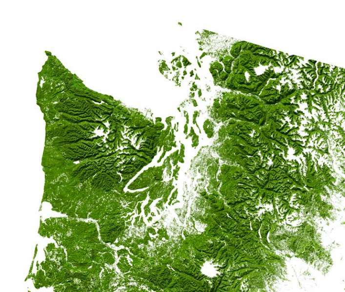
Olympic National Park and the northern Cascades, Washington state
华盛顿州的奥林匹克国家公园与北部的瀑布
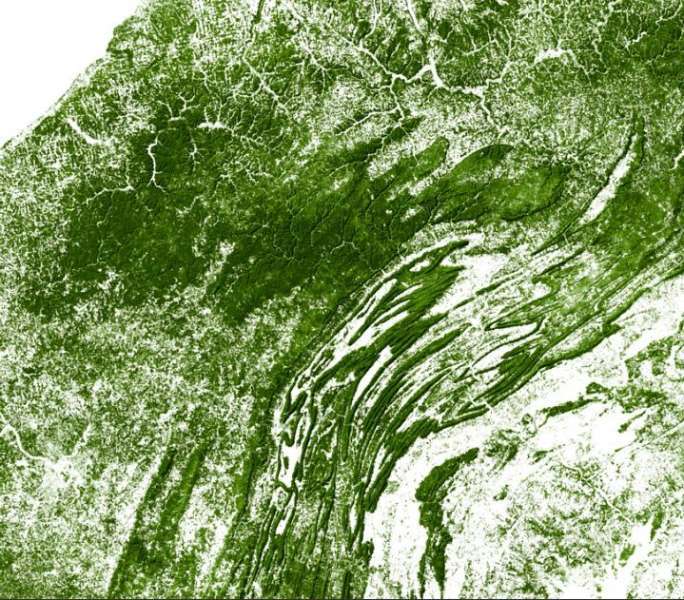
Northern Pennsylvania and the Appalachians
北宾夕法尼亚和阿帕拉契山脉
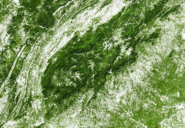
Chattahoochee National Forest and the Great Smoky Mountains
查特胡奇河国家森林公园和大烟雾山
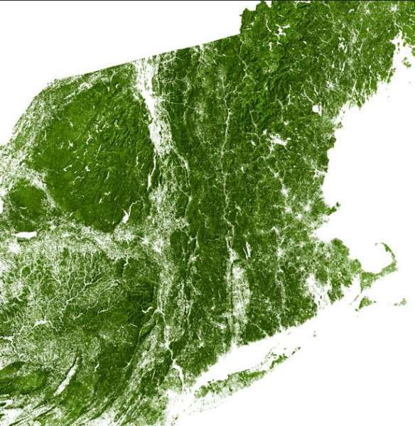
Forestsof the Northeast
东北部的森林地带
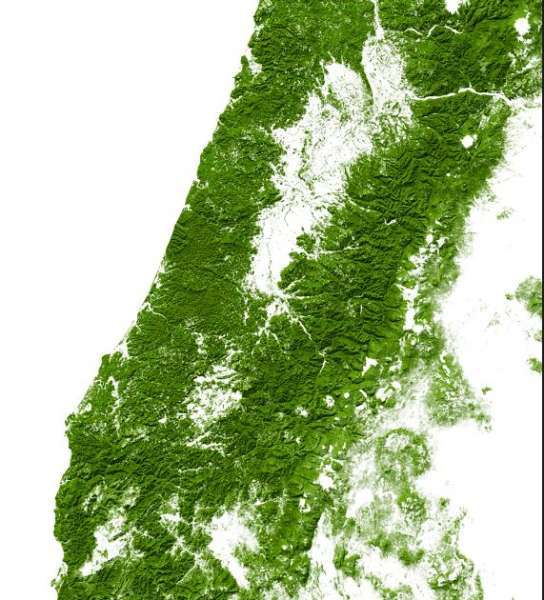
Forestsof Northern California and Oregon
北加利福尼亚和俄勒冈的森林地带
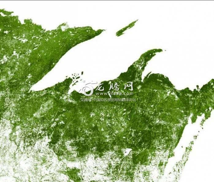
Forestsof Minnesota, Wisconsin and Michigan
明尼苏达州、威斯康星州和密歇根州的森林
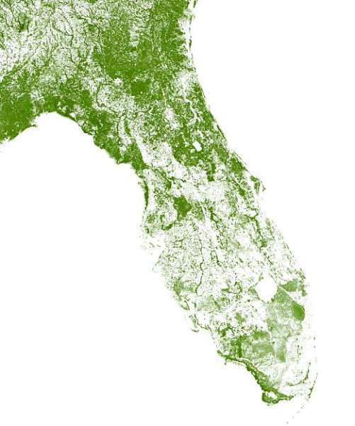
Forestsof southern Florida
佛罗里达州南部地区的森林
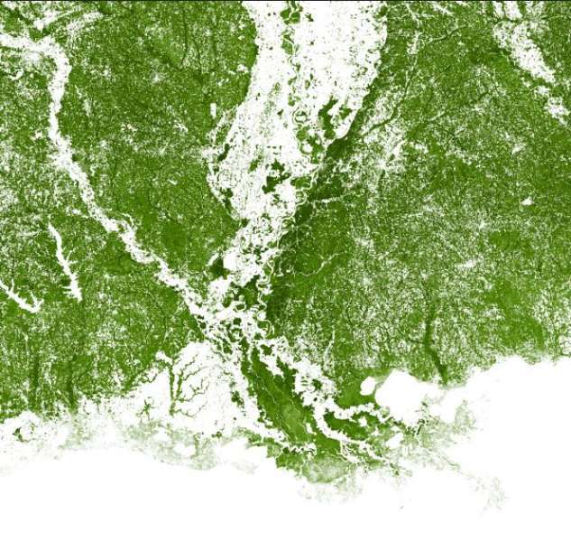
Forestsof Louisiana
路易斯安那州的森林
Forestsof the northern Rocky Mountains
落基山脉北段的森林
版权声明
我们致力于传递世界各地老百姓最真实、最直接、最详尽的对中国的看法
【版权与免责声明】如发现内容存在版权问题,烦请提供相关信息发邮件,
我们将及时沟通与处理。本站内容除非来源注明五毛网,否则均为网友转载,涉及言论、版权与本站无关。
本文仅代表作者观点,不代表本站立场。
本文来自网络,如有侵权及时联系本网站。
图文文章RECOMMEND
热门文章HOT NEWS
-
1
Why do most people who have a positive view of China have been to ...
- 2
- 3
- 4
- 5
- 6
- 7
- 8
- 9
- 10
推荐文章HOT NEWS
-
1
Why do most people who have a positive view of China have been to ...
- 2
- 3
- 4
- 5
- 6
- 7
- 8
- 9
- 10
